The chain of mountains, islands, and hidden magma chambers beneath the United States shapes landscapes, hazards, ecosystems, and even climate in ways most people rarely see. This article explains why volcanoes in the us matter, how they work, what scientists know (and don’t), how monitoring protects communities, and which research questions remain open. You will find an evidence-based synthesis drawing on government observatories, peer-reviewed research, satellite remote sensing, and decades of field work—presented for a general reader who wants a deeper, scientifically rigorous account without technical overload.
Volcanoes in the us: A science-led guide to America’s active and dormant volcanoes
Background and scientific context: How volcanic systems form and evolve in the United States
Volcanism in the United States arises from several fundamentally different tectonic settings: subduction zones, continental hotspots, rift- and back-arc systems, and intraplate volcanism associated with deep mantle upwellings. Each setting produces distinctive magma chemistry, eruption styles, frequencies, and hazards. Understanding those settings is the first step to assessing risk and interpreting the scientific literature.
Subduction-zone volcanism dominates the U.S. Pacific Northwest and Alaska. There, the oceanic Juan de Fuca and Pacific plates dive beneath the North American plate. Water released from the descending slab lowers the melting point of the overlying mantle wedge, generating silica-rich magmas that can feed explosive stratovolcanoes—Mount St. Helens, Mount Rainier, and the Aleutian chain are canonical examples. These volcanoes produce explosive eruptions, pyroclastic flows, and extensive ash falls.
Hawaii represents classic intraplate, hotspot volcanism. A steady mantle plume supplies basaltic magma that rises through the lithosphere and erupts effusively: long lava flows, shield volcano profiles (Mauna Loa, Mauna Kea), and frequent flank eruptions (Kīlauea). The low-viscosity magma tends to produce less explosive eruptions but larger lava flows and significant gas emissions.
Large caldera systems—Yellowstone and Long Valley—reflect another class of volcanism where episodic, very large explosive eruptions (caldera-forming) have occurred in the geologic past. Those events are rare on human timescales but shape long-term hazard perception and research priorities.
To talk scientifically about volcanoes we use several key terms: magma (molten rock beneath the surface), lava (magma once erupted), pyroclastic density currents (fast-moving hot mixtures of ash, gas and rock), tephra (airborne ash and fragments), lahar (volcanic mudflow), and caldera (a large volcanic collapse feature produced by massive eruptions). These definitions help distinguish eruption mechanisms and expected impacts across U.S. volcanic provinces.
Volcanoes in the US: Distribution, types, and geological drivers
The United States hosts volcanoes in several provinces with distinct origins, activity histories, and monitoring needs. Broadly, U.S. volcanic activity clusters in five regions: the Aleutian–Alaska arc, the Cascades of the Pacific Northwest, the Hawaiian hotspot, the Basin and Range/Intermountain West (including Yellowstone and Long Valley), and isolated fields such as the California volcanic centers and the volcanic provinces of the Southwest. Each region’s tectonic context controls eruption frequency, magma composition, and hazard types.
Alaska and the Aleutians: The most volcanically active region in the country by frequency. The Aleutian arc contains dozens of historically active volcanoes that frequently produce explosive eruptions and volcanic ash that reaches major North Pacific flight paths. Alaska Volcano Observatory (AVO), jointly operated by USGS, University of Alaska Fairbanks, and NOAA, monitors these systems.
The Cascade Range: Stretching from northern California through Oregon and Washington into British Columbia, Cascades volcanoes are subduction-driven stratovolcanoes. Mount St. Helens’ 1980 eruption remains the most detailed modern case study of explosive subduction-related eruptions in the U.S., demonstrating hazards (pyroclastic flows, ashfall, lahars) that threaten populated valleys and infrastructure.
Hawaii: Basaltic shield volcanoes such as Kīlauea and Mauna Loa are fed by a deep mantle plume. Their eruptions are typically effusive, producing voluminous lava flows that reshape coastlines and infrastructure. Kīlauea’s 2018 lower East Rift eruption is recent evidence of how rapidly lava flows can disrupt communities.
Yellowstone and large calderas: Yellowstone is an active hydrothermal and volcanic system with a long record of past explosive eruptions, the largest about 630,000 years ago (the Lava Creek eruption). Yellowstone’s hazards today are dominated by geothermal activity, seismicity, and smaller explosive events; the probability of a comparably large eruption on human timescales is extremely low, according to USGS probabilistic assessments.
Scientific evidence and current research: How we study volcanoes in the US
Volcanic science in the U.S. combines field geology, petrology and geochemistry, geochronology, geophysics (seismicity, magnetotellurics, gravity), geodesy (GPS and InSAR), gas geochemistry, and numerical modeling. These complementary methods allow researchers to map past eruptions, determine magma composition and storage depths, detect unrest, and estimate hazards.
Seismic studies: Seismology detects magma movement and crustal deformation. Networks maintained by USGS, AVO, and academic partners identify volcanic tremor, low-frequency earthquakes, and swarms that often precede eruptions. Seismic tomography—using many earthquakes to build 3-D images of the crust and upper mantle—has revealed melt-bearing regions beneath volcanoes and has been central to debates such as the nature of the Yellowstone heat source.
Geodesy and InSAR: Precision GPS and Interferometric Synthetic Aperture Radar (InSAR) measure surface deformation at millimeter to centimeter scales. Inflation (uplift) or deflation (subsidence) of volcanic edifices can indicate magma intrusion or withdrawal. For example, InSAR and GPS were crucial during the 2018 Kīlauea sequence to map rapid ground deformation that accompanied eruptive fissures.
Geochemistry and petrology: Analysis of erupted rocks and gases yields constraints on magma source regions, mixing processes, degassing, and evolution. Volatile content (H2O, CO2, SO2) controls eruption explosivity: magmas with higher dissolved water generate more explosive eruptions under rapid decompression. Gas monitoring at U.S. volcanoes—sulfur dioxide flux measurements in particular—helps detect increased magma ascent.
Remote sensing and ash detection: NOAA and NASA provide satellite-based thermal and ash-plume detection used by the Volcanic Ash Advisory Centers (VAACs). The Anchorage VAAC, for instance, supports aviation safety by issuing advisories for Alaskan eruptions.
Interdisciplinary research: Increasingly, volcanology draws on computer models that couple magma ascent, conduit flow, ash dispersal, and atmospheric transport. Probabilistic hazard modeling synthesizes geologic history and monitoring data to produce eruption forecasts and risk maps used by emergency managers.
Volcanoes in the US: Hazards, monitoring, and community risk management
Different volcano types produce different hazards. Subduction-related stratovolcanoes commonly generate explosive eruptions, ashfall, pyroclastic flows, and lahars that can travel tens of kilometers down river valleys. Basaltic shield volcanoes produce long lava flows and hazardous gas emissions (SO2 and CO2). Calderas and silicic systems can generate widespread ashfalls with regional climatic and infrastructural impacts. In the U.S., hazard planning must account for these variations and the proximity of populations and infrastructure.
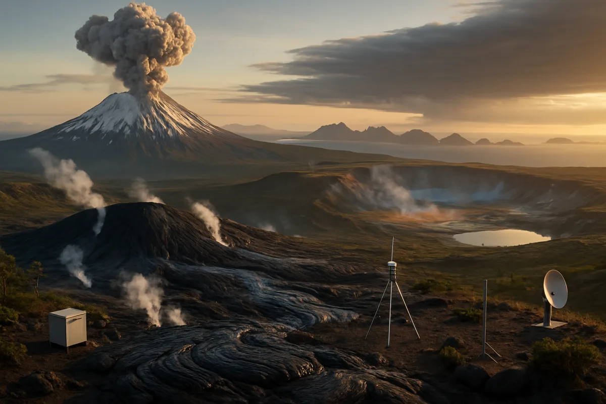
Monitoring and mitigation: The United States Geological Survey (USGS) leads volcano monitoring through a network of observatories (Cascades Volcano Observatory, Alaska Volcano Observatory, Hawaiian Volcano Observatory, Yellowstone Volcano Observatory, and others). Monitoring priorities include seismic networks, continuous GPS, gas sensors, webcams, and satellite surveillance. Data feeds support operational alert levels, public advisories, flight notifications, and lahar early-warning systems in high-risk drainages.
Community preparedness: Volcano risk reduction requires translating scientific signals into actionable decisions. Hazard maps, land-use planning, evacuation routes, public education, and ash-cleanup protocols are part of resilience. The USGS collaborates with state and local emergency managers to develop response scenarios tailored to each volcano’s hazards.
Detailed data table
| Volcano / Region | Representative Type | Notable eruptive history or last major event | Primary hazards | Monitoring agencies / institutions | Scientific importance | Known limitations in current understanding |
|---|---|---|---|---|---|---|
| Mount St. Helens (Cascades) | Stratovolcano (subduction) | Major explosive eruption, 1980 (well-documented) | Pyroclastic flows, ashfall, lahars, debris avalanches | USGS CVO, State emergency agencies | Key modern case study of explosive dome-collapse and rapid sector collapse dynamics | Predicting precise timing and volume of future dome collapses remains challenging |
| Kīlauea (Hawaii) | Shield volcano (hotspot) | Frequent activity; major lower East Rift eruption, 2018; ongoing episodic eruptions | Lava flows, gas emissions (SO2), coastal inundation where flows enter sea | USGS Hawaiian Volcano Observatory, University of Hawaii | Model system for basaltic rift eruption dynamics and magma plumbing | Complex shallow plumbing and transitions from effusive to explosive behavior in certain settings |
| Mauna Loa (Hawaii) | Shield volcano (hotspot) | Large-volume eruptions; most recent eruption, 2022 | Lava flow inundation over large areas, infrastructure loss | USGS HVO, local authorities | Largest subaerial volcano by volume; critical for understanding magma supply rates | Forecasting flow paths and timing in densely instrumented but complex systems |
| Yellowstone Caldera (Intermountain West) | Caldera / hydrothermal system | Large caldera-forming eruptions are prehistoric; last major caldera-forming ~630,000 years ago | Hydrothermal explosions, seismicity, regionally distributed ash in rare large events | USGS Yellowstone Volcano Observatory, academic researchers | High public interest; natural laboratory for magma chamber processes and crustal deformation | Debate over depth and geometry of heat source (mantle plume vs. upper-mantle processes) |
| Long Valley Caldera (California) | Silicic caldera | Bishop Tuff eruption ~760,000 years ago; episodic unrest since | Potential ash-producing eruptions; hydrothermal activity and ground deformation | USGS, California Geological Survey | Important for studies of long-term magmatic unrest and hydrothermal systems | Assessing eruption probability from episodic unrest remains uncertain |
| Aleutian / Alaska arc (e.g., Cleveland, Shishaldin) | Arc stratovolcanoes / composites | Frequent historical eruptions; multiple active centers in recent decades | Explosive ash plumes, aviation hazards, pyroclastic flows | Alaska Volcano Observatory (USGS/UA/NOAA) | Critical for aviation safety and understanding subduction system volcanism | Remote locations complicate dense instrumentation; ash plume forecasting remains complex |
What scientists still do not know: Key uncertainties about volcanoes in the US
Volcanology has made major progress, but important uncertainties persist. Some of the most consequential unknowns include:
1) Timing and triggers of eruptions. While seismicity and deformation can indicate increased magma movement, translating those signals into precise eruption timing and magnitude forecasts is still limited. Many eruptions are preceded by clear unrest, but not all unrest culminates in eruption, and the transition from intrusion to eruption depends on complex rock mechanics, magma viscosity, volatile content, and pre-existing crustal structures.
2) Magma storage geometry. Seismic tomography and geodetic inversions reveal melt-bearing regions beneath volcanoes, but defining the exact shape, connectivity, and melt fraction of magma reservoirs remains difficult. Small differences in melt fraction (a few percent) can change the mechanical behavior from a mostly solid mush to an eruptible magma body.
3) Source of Yellowstone heat. There is broad scientific consensus that Yellowstone hosts a significant heat source and a shallow crustal magma body, but debate continues about the scale and origin of mantle contributions (deep plume vs. upper mantle processes). Multiple lines of evidence (seismology, xenoliths, geochemistry) are being integrated, but uncertainties persist.
4) Eruption forecasting and probabilistic modeling. Developing robust probabilistic forecasts that combine geological history, monitoring data, and physics-based models is an active research frontier. Such forecasts must quantify uncertainties explicitly to be useful for policy and emergency management.
5) Impact of climate and eruptive interactions. Large explosive eruptions can alter climate on seasonal to decadal timescales through stratospheric aerosol injection, but the coupling between volcanic emissions, atmospheric processes, and regional climate remains an area of ongoing study. For example, ash-cloud chemistry, sulfate aerosol formation, and regional precipitation changes are complex and model-sensitive.
Why this matters: Societal, environmental, and scientific significance of volcanoes in the US
Volcanoes in the United States influence people’s lives in immediate and long-term ways. Immediate impacts include loss of life and property near erupting vents, contamination of water supplies through ash and lahars, respiratory hazards from fine ash, and disruption to air travel and supply chains from ash clouds. Economically, eruptions can damage infrastructure, agriculture, and tourism.
Beyond immediate hazards, volcanism shapes landscapes and ecosystems, produces fertile soils, and hosts geothermal resources for energy. Geothermal production in parts of the western U.S. relies on heat associated with magmatic or hydrothermal systems. Volcanic rocks preserve records of Earth’s interior processes and inform our understanding of crustal growth, tectonics, and mantle dynamics.
Scientifically, monitoring and research at U.S. volcanoes contribute to global volcanology. Techniques developed during monitoring and response—rapid deployment of seismometers, real-time gas monitoring, and integrated hazard mapping—are exported internationally and improve global hazard science.
Future research and outlook: Technologies, priorities, and capacity building
Research priorities for U.S. volcanology emphasize improved forecasting, expanded monitoring coverage, interdisciplinary modeling, and community resilience. Several technological and scientific advances are central:
– Dense sensor networks and real-time telemetry. Low-cost seismometers, continuous gas sensors, and ubiquitous GPS networks increase the ability to detect subtle precursors. Coupling these with rapid telemetry ensures timely alerts.
– Satellite remote sensing. Increasing satellite revisit rates and improved InSAR processing provide near-real-time deformation maps even for remote Alaskan volcanoes. Thermal, gas, and ash-plume sensors from NASA and international partners enhance global surveillance.
– Machine learning and data assimilation. Techniques that integrate diverse datasets (seismic, geodetic, gas) can detect patterns human analysts might miss, helping to identify precursory signals. However, these methods must be calibrated on diverse case studies and treated with caution to avoid overfitting.
– Interdisciplinary hazard science. Linking physical forecasts with social science—community preparedness, communication science, and decision analysis—improves how warnings translate into protective action.
– Field-based petrology and geochronology. Precise dating and chemical analysis of eruption deposits remain essential for estimating recurrence intervals and building realistic probabilistic models.
Frequently Asked Questions
How many volcanoes are there in the United States?
The number depends on definitions (active in the Holocene vs. historical). The U.S. contains hundreds of volcanic centers when counting Alaskan and Aleutian islands; dozens are considered historically active and are routinely monitored by observatories such as AVO and USGS.
Which U.S. volcano is most likely to erupt next?
Short-term likelihood changes with observed unrest. The most frequently erupting centers—Kīlauea in Hawaii and several Aleutian volcanoes—are statistically more likely to erupt in the near term because of their high baseline activity. However, eruptive forecasts must rely on current monitoring data and formal alert systems.
Could Yellowstone have a ‘supereruption’ soon?
Current research and USGS probabilistic assessments indicate that a “supereruption” at Yellowstone in the near term is extremely unlikely. Yellowstone shows ongoing seismicity and hydrothermal activity; large caldera-forming eruptions are rare on timescales of hundreds of thousands of years.
How do volcanoes affect air travel?
Volcanic ash is hazardous to aircraft because ash can abrade engines and melt onto components. NOAA and VAACs issue ash advisories; airports and airlines act on those advisories to reroute or ground flights when ash clouds are present.
What should residents do if a nearby volcano becomes active?
Follow official guidance from local emergency managers and the USGS observatory responsible for that volcano. Preparations include knowing evacuation routes, creating an emergency kit (including N95 masks for ash), and having a plan for pets and livestock.
Do volcanic eruptions cause long-term climate change?
Large explosive eruptions can inject sulfur aerosols into the stratosphere, reflecting sunlight and producing temporary (1–3 year) global cooling. However, such effects are transient; long-term climate change is driven by sustained greenhouse gas forcing rather than isolated volcanic events.
Sources and Further Reading
- United States Geological Survey (USGS) Volcano Hazards Program. Volcano information, monitoring, and hazard assessments. (ongoing). https://www.usgs.gov/volcanoes
- Smithsonian Institution Global Volcanism Program. Volcano bibliographies and eruption catalogs. (ongoing). https://volcano.si.edu
- Alaska Volcano Observatory (AVO), USGS / University of Alaska Fairbanks / NOAA. Monitoring and research on Alaskan volcanoes. (ongoing). https://avo.alaska.edu
- USGS Hawaiian Volcano Observatory (HVO). Kīlauea, Mauna Loa monitoring and reports; 2018 Kīlauea eruption summaries. (ongoing). https://www.usgs.gov/hvo
- USGS Cascades Volcano Observatory (CVO). Information on Mount St. Helens, Mount Rainier, and other Cascades volcanoes. (ongoing). https://www.usgs.gov/observatories/cvo
- National Oceanic and Atmospheric Administration (NOAA) / VAAC Anchorage. Volcanic ash advisory and aviation-related resources. (ongoing). https://www.aviationweather.gov/volcanic
- Yellowstone Volcano Observatory (YVO), USGS. Monitoring and research resources for Yellowstone National Park. (ongoing). https://www.usgs.gov/observatories/yvo
- NASA Earth Science. Satellite remote sensing of volcanic eruptions, InSAR, and thermal imaging applications. (ongoing). https://earthdata.nasa.gov
SEO METADATA
- SEO Title: volcanoes in the us — science guide to risks, monitoring, and research
- Meta Description: An evidence-based, in-depth guide to volcanoes in the US: distribution, hazards, monitoring, and the science that informs risk decisions.
- Suggested URL Slug: volcanoes-in-the-us-guide
- Primary Keyword: volcanoes in the us
- Secondary Keywords: US volcanoes, volcanic hazards, Yellowstone, Kīlauea, Mount St. Helens, Alaska volcanoes, volcanic monitoring, USGS volcanoes, InSAR volcano monitoring, volcanic ash aviation
- Search Intent: Informational
- Suggested Image Alt Text (3–5): “Aerial view of a volcanic summit with steam and snow on flanks”; “Satellite thermal image of lava flows on Kīlauea”; “Seismic and GPS instruments deployed on a volcano flank”; “Ash plume rising from an explosive eruption over a mountain”
- Suggested Internal Links: state volcano hazard pages; USGS volcano monitoring updates; local emergency management guidance; research summaries on InSAR and volcanic deformation; educational resources on volcanic hazards for schools
Advances in instrumentation and modeling have narrowed some uncertainties, but translating scientific signals into timely, reliable forecasts remains an interdisciplinary challenge. The combination of dense monitoring, transparent communication between scientists and emergency managers, and public preparedness is the best available strategy for reducing volcanic risk. Continued investment in observatory capacity, satellite remote sensing, and community engagement will keep the United States better prepared for the diverse ways volcanoes can affect society, ecosystems, and infrastructure.

Dr. Morgan directed the Archives Program from 2014 to 2017, gaining extensive experience in research documentation, information management, and the preservation of scholarly resources. Throughout her career, she has worked closely with academic publications and research materials, developing expertise in evaluating scientific sources and communicating complex topics to broad audiences.
Her primary areas of specialization include scientific publishing, research communication, editorial review, and the translation of technical research into accessible educational content. She has contributed to projects involving space science, astronomy, environmental science, history, archaeology, and emerging scientific discoveries, always emphasizing accuracy, transparency, and the responsible presentation of evidence.
As Editorial Director of Muskurahat.us, Dr. Morgan leads the editorial review process for scientific articles, ensuring that content is based on reputable sources, peer-reviewed research whenever available, and publications from recognized universities, research institutions, and international scientific organizations.
She is committed to promoting scientific literacy through clear, engaging, and well-documented articles that help readers better understand scientific discoveries and their impact on society. Her editorial philosophy is founded on accuracy, intellectual integrity, independent journalism, and continuous learning as scientific knowledge evolves.
Through her work at Muskurahat.us, Dr. Morgan supports the publication of trustworthy scientific content that makes complex research accessible to readers around the world while maintaining rigorous editorial standards.