Long before satellites, lasers, or even the magnetic compass, a single calculation in the third century BCE demonstrated how careful observation and geometric thinking could scale from a shadow on the ground to the size of the planet. The method is deceptively simple: measure a shadow, know the distance to another location where the sun casts no shadow at the same moment, and use angles to infer the full circumference of the Earth. That calculation — attributed to the Alexandrian polymath Eratosthenes — endures both as a triumph of ancient science and as a pedagogical favorite because it exposes how physical reasoning can convert a local phenomenon into a global measurement.
Setting the scene in antiquity
In about 240 BCE Eratosthenes, who ran the great Library of Alexandria, put together pieces of geographic and astronomical knowledge available at the time to produce a numerical estimate for the Earth’s circumference. He relied on a few key facts: that on the summer solstice at a place called Syene, near modern Aswan, the sun would stand directly overhead at noon so that a vertical rod cast no shadow; that Alexandria, roughly due north of Syene, did cast a shadow at the same hour; and that surveyors had charted the distance between those two Egyptian cities. Combining a measured shadow angle and a distance, he applied elementary geometry to compute the circumference of the globe.
The basic geometric argument
Imagine the Earth as a sphere and draw radii to Alexandria and Syene. If the sun is far enough away, its rays can be treated as parallel when they hit the Earth. Where the sun is directly overhead, the ray is tangent to the surface and produces no shadow; elsewhere, the incoming rays make an angle with the local vertical. The difference in those vertical angles corresponds to the central angle between the two cities at the center of the Earth. Measuring that shadow angle at Alexandria gives the fraction of the full circle that separates the two places. Multiply that fraction by the distance between the cities and you obtain the full circumference.
Numbers Eratosthenes used
The historical account attributes to him a shadow angle of about 7 degrees 12 minutes, roughly 1 50th of a full circle. If the distance between Alexandria and Syene was taken as 5,000 stadia, then the full circumference computed as 50 times that distance gives 250,000 stadia. Some later sources adjusted the figure slightly to 252,000 stadia, perhaps to make it divide neatly by certain numbers. Even without knowing exactly which stadion Eratosthenes used, the method itself is elegantly straightforward.
Myths, wells, and the story that stuck
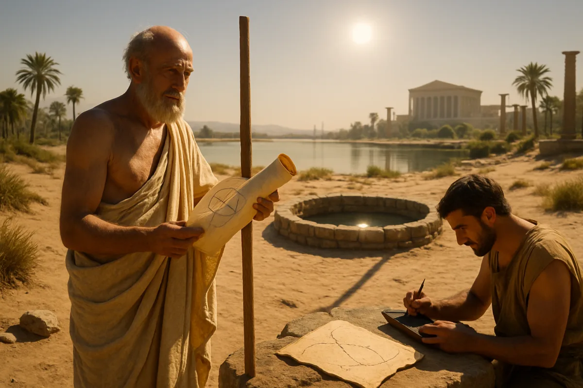
Popular retellings often add vivid details: a deep well at Syene into which the solstice sun shone straight to the bottom, or the image of Eratosthenes himself planting a stick in Alexandria and watching its shadow. These images, propagated in modern accounts and broadcasts, are memorable but partly legendary. Ancient sources do mention a well at Syene, and it was used as evidence that the town lay on the tropic where the sun stands overhead at solstice, yet it probably played no direct role in Eratosthenes personal measurement. He seems to have assembled measurements from different observers and from professional surveyors rather than making a long trek down the Nile himself.
Where history and legend blur
The embellishments do not diminish the intellectual achievement, but they can obscure how the calculation actually came about. Eratosthenes was a scholar accustomed to synthesizing reports, maps, and lists of distances compiled by travelers and surveyors. Using available shadow measurements and a trusted distance between cities, he applied a simple but powerful inference. It is helpful to separate the mental experiment from the romantic image: the idea, not the theatrics, is the lasting legacy.
The stubborn uncertainty of the stadion
One persistent obstacle to pinning down exactly how accurate Eratosthenes was in modern units is the stadion, the ancient unit of length he used. Different regions and epochs used stadia of differing lengths; estimates range from about 157 meters to roughly 185 meters. That variance is large enough that translating 250,000 stadia into meters yields substantially different modern figures depending on which stadion you adopt. A short stadion gives a circumference under 40,000 kilometers, while the longer stadion produces a value closer to the actual Earth circumference of roughly 40,075 kilometers. Scholars still debate which stadion Eratosthenes intended, and that single ambiguity clouds any definitive verdict on the numerical accuracy of his result.
Why the stadion matters so much
Ancient authors often reported distances as numbers of stadia without a standardized yardstick. Over centuries those stadia were copied, translated, and sometimes converted by later geographers who had different local standards. Attempts to map ancient itineraries back to modern kilometers require careful philological and archaeological work to determine which stadion was in use in a particular context. For Eratosthenes, solving that puzzle would be the final step in placing his famous figure precisely on a modern scale.
Errors that cancel and the role of luck
A further complication is that several of Eratosthenes inputs were not perfectly accurate. Syene is not exactly on the Tropic of Cancer, and it is slightly east of due south from Alexandria. The measured distance between the cities was an estimate and likely rounded. Each of these small inaccuracies would have introduced an error into a naive reconstruction. Remarkably, as later scholars pointed out, many of the individual errors tended to push the result in opposite directions and largely offset one another. This fortuitous cancellation of errors helps explain why the ancient estimate can appear so close to modern values despite imperfect data and measurement techniques.
How historians unpack that luck
Researchers have retraced the geometry with corrected positions and reconstructed distances to quantify the biases introduced by misalignment and misestimation. The conclusion is subtle: the calculation was conceptually sound and the reasoning robust, but the numerical proximity to modern values benefited from a combination of good geometric insight and serendipitous error compensation. That nuance is important because it reminds us that science is both method and circumstance; the same method, applied with slightly different inputs, could have produced a noticeably different number.
Why the work still matters
Eratosthenes contribution is not best judged only by the digits he wrote down. The deeper achievement was the willingness to combine observation, geometry, and the assumption that the Earth is spherical and that sunlight comes from a great distance so that rays are effectively parallel. Those assumptions were not trivially accepted at the time and were part of a broader intellectual shift toward quantitative natural philosophy. The experiment is a model of how minimal apparatus and clear thinking can produce extraordinary insight.
Teachers repeat Eratosthenes experiment in classrooms because it encapsulates scientific thinking: a hypothesis, a measurement, a simple model, and a computation that scales up local data. Students who plant rods, mark shadows, and compute the implied circumference learn not just a number but a method. They also encounter real-world issues: measurement error, unit ambiguity, and the interpretive choices historians face when reconstructing ancient practice. In that sense the exercise remains both a practical lesson in geometry and a historical window into how knowledge was produced in antiquity.
Even today, with GPS and radio science able to measure the planet with sub-meter and sub-millimeter precision, Eratosthenes approach retains educational and philosophical value. It reminds us that many of the largest scientific advances began with simple observations used in clever ways. Understanding the uncertainties about the stadion and the precise logistics of his measurements does not detract from this legacy; instead it enriches our appreciation for how empirical reasoning matured in the ancient world and why that maturity matters for the history of science.
Ultimately, the story of measuring the Earth with a stick and a shadow is both a demonstration of technical ingenuity and a narrative about the human capacity to infer the global from the local. The precise number Eratosthenes recorded will continue to be debated in terms of which stadion to prefer, and modern reconstructions will keep refining the historical context. But the essential message is clear and enduring: with careful thought and modest means, observers in antiquity reached conclusions that still command our admiration, and their work continues to inspire the way we teach and think about the natural world

Dr. Morgan directed the Archives Program from 2014 to 2017, gaining extensive experience in research documentation, information management, and the preservation of scholarly resources. Throughout her career, she has worked closely with academic publications and research materials, developing expertise in evaluating scientific sources and communicating complex topics to broad audiences.
Her primary areas of specialization include scientific publishing, research communication, editorial review, and the translation of technical research into accessible educational content. She has contributed to projects involving space science, astronomy, environmental science, history, archaeology, and emerging scientific discoveries, always emphasizing accuracy, transparency, and the responsible presentation of evidence.
As Editorial Director of Muskurahat.us, Dr. Morgan leads the editorial review process for scientific articles, ensuring that content is based on reputable sources, peer-reviewed research whenever available, and publications from recognized universities, research institutions, and international scientific organizations.
She is committed to promoting scientific literacy through clear, engaging, and well-documented articles that help readers better understand scientific discoveries and their impact on society. Her editorial philosophy is founded on accuracy, intellectual integrity, independent journalism, and continuous learning as scientific knowledge evolves.
Through her work at Muskurahat.us, Dr. Morgan supports the publication of trustworthy scientific content that makes complex research accessible to readers around the world while maintaining rigorous editorial standards.