Most of us imagine mountains as jagged ridgelines that we can climb, snow-capped silhouettes against the sky. But the true longest mountain range on Earth is almost entirely invisible from land: a continuous chain of volcanoes and rifts that winds roughly 65,000 kilometers around the planet, beneath thousands of meters of seawater. This article explains what that undersea spine is, how it was first revealed by a determined mapmaker working on land, and why understanding and mapping the seafloor matters for science, safety, and our sense of what the world actually is.
The mid-ocean ridge: a mountain range hidden beneath the sea
The feature at the center of this story is usually called the mid-ocean ridge. It is not a single mountain in the way we picture the Alps or the Rockies, but a global system of connected volcanic ridges and rift valleys that snakes down the middle of ocean basins. Where tectonic plates pull apart, magma rises to fill the gap, cools, and builds new oceanic crust. Over geologic time these processes create continuous elevated topography that, if laid end to end on land, would be several times longer than any continental chain.
Scale and appearance
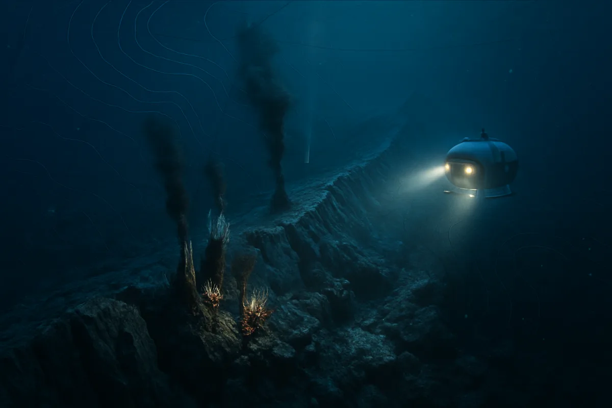
On average the crest of the ridge sits about 2,500 meters below sea level, which means roughly 8,200 feet of water overhead. In some places the ridge is shallow enough that tiny islands form; in others it lies in the abyssal dark. The ridge system is punctuated by a central rift valley in many segments—an elongate depression running along its spine where the crust is actively spreading. Rather than a ragged mountainous skyline, imagine a submerged backbone: long, continuous, and composed of volcanic peaks, fissures, and pillow lavas shaped by underwater eruptions.
Why most people have never seen it
More than ninety percent of this range is underwater, out of sight and beyond the reach of casual observation. Even with modern technology, direct human observation of the deep seafloor is vanishingly small: explorers have actually looked at far less than 0.001 percent of the deep ocean floor. Much of what we know comes from remote sensing, sonar surveys, and carefully plotted bathymetric maps rather than photographs taken in situ.
Marie Tharp and the making of the modern seafloor map
The modern understanding of the mid-ocean ridge owes a great deal to Marie Tharp, a cartographer at Columbia University’s Lamont Geological Observatory in the 1950s and 1960s. Because women were often not allowed on research vessels at the time, Tharp worked ashore translating depth soundings and other measurements into detailed, hand-drawn profiles of the ocean floor. Those profiles gradually stitched together into a global picture that looked nothing like the old map of static continents and empty oceans.
From data points to a new paradigm
As Tharp plotted thousands of depth readings across the North Atlantic, a striking pattern emerged: a long, continuous valley running down the center of an elevated ridge. To her it looked like a rift—evidence of a place where the Earth’s crust was tearing apart. Her collaborator, Bruce Heezen, initially rejected the implication because the idea of moving continents was still controversial. Tharp famously let the maps speak for themselves; she continued to produce clear, detailed charts that made the structure impossible to ignore.
Maps that changed geology
The first Atlantic map produced by Tharp and her colleagues appeared in 1957, and an elaborately painted world floor map followed in 1977. These visualizations made the mid-ocean ridge tangible and persuasive, helping to move plate tectonics from fringe hypothesis to mainstream scientific theory. Tharp’s maps were more than cartography; they were instruments of discovery and reinterpretation, showing how much of the planet is built from processes that unfold beneath the waves.
What the ridge tells us about Earth’s processes
The mid-ocean ridge is a living illustration of plate tectonics. It is where oceanic plates are created, where magma wells up, solidifies, and spreads outward. These processes control not only the formation of the seafloor but also the chemistry of the oceans, the distribution of volcanic activity, and even the concentration of valuable minerals around hydrothermal vents.
Hydrothermal vents and unique ecosystems
Along many ridge segments, seawater percolates into cracks, becomes superheated by hot rock, then gushes back out through chimneys as mineral-rich plumes. These hydrothermal vents support unique ecosystems that rely on chemosynthesis rather than sunlight. Tubeworms, clams, and bacteria thrive in chemically rich plumes, forming biological hotspots on an otherwise sparse deep seafloor. The existence of these communities altered biologists’ assumptions about where and how life can persist.
Geologic and climatic implications
Mid-ocean ridges influence long-term climate and ocean chemistry. The rate of seafloor spreading affects how much fresh basalt is exposed, which in turn influences rates of chemical weathering and the sequestration of carbon dioxide over geologic timescales. On shorter timescales, volcanic activity and tectonic shifts along the ridge can trigger localized sea-floor changes, undersea earthquakes, and tsunamis.
Mapping the unmapped: the present state of seafloor surveys
We have better tools now than Tharp did—multibeam sonar, autonomous vehicles, satellites that infer ocean-floor structure from sea-surface height—but our coverage is still incomplete. Detailed, high-resolution mapping of the global seafloor rose from about 6.2 percent in 2014 to roughly 26 percent by 2024, and more recent estimates put modern high-resolution coverage near 28.7 percent. That still leaves the majority of the ocean floor either poorly mapped or effectively unknown.
Challenges to comprehensive mapping
Ocean mapping is expensive and time-consuming. Ships equipped with multibeam echosounders must traverse vast distances slowly to gather fine-scale data. Deep submersibles capable of direct observation are limited in number, costly to operate, and can only access small areas at a time. Political and logistical constraints, as well as the sheer scale of the oceans, mean that progress is steady but incremental. Even when satellites provide broad clues to seafloor topography, they cannot replace the precision and detail of ship-based surveys.
Why more mapping matters
Better maps improve navigation safety, help locate undersea hazards, and inform cable routing for global communications. From a scientific standpoint, they allow researchers to target biologically rich areas like vent fields and to model geophysical processes with greater fidelity. Maps also underpin claims about seabed resources and national jurisdiction in international law, so the stakes extend into geopolitics and resource management as well.
The human story: curiosity, exclusion, and discovery
Tharp’s story is as much social as it is scientific. Her exclusion from ships because she was a woman limited the kinds of fieldwork she could do, yet it may also have focused her on the synthesis of data in a way that produced a transformative view. Her patience—turning raw soundings into readable images—and her quiet insistence on letting maps carry the argument exemplify one mode of scientific influence: making complex data visible, compelling, and undeniable.
Explorers, technology, and public imagination
There is a romantic element to deep-sea exploration that the public often associates with images of daring manned dives or dramatic discoveries of giant squids. In practice, much modern exploration is remote, incremental, and collaborative. Research ships, autonomous underwater vehicles (AUVs), remotely operated vehicles (ROVs), and satellite altimetry all contribute pieces of the puzzle. The thrill is not just in encounters with strange lifeforms but in the slow expansion of human knowledge about the majority of our planet that has long been treated as a blank canvas.
Citizen science and the future of mapping
Efforts to map the seafloor are increasingly collaborative. International campaigns such as the UN-endorsed Seabed 2030 aim to accelerate high-resolution mapping through partnerships among governments, research institutions, and private companies. The public can play roles too: scientists are using crowd-sourced image annotation, open data platforms, and educational outreach to broaden participation and awareness. The project is as much about building tools and partnerships as it is about collecting data.
Thinking about the mid-ocean ridge shifts how we picture Earth. The continents and islands we walk on are a relatively thin veneer over a planet where two-thirds of the surface is sculpted by forces hidden beneath the waves. Marie Tharp’s maps taught us to see that hidden landscape; modern sonar and submersibles continue the work, revealing a world of rift valleys, volcanoes, hydrothermal vents, and ecosystems adapted to an alien darkness. As mapping becomes more complete, the ridge’s long, winding presence will become less of an obscure fact and more a central part of the story of our planet—its formation, its life, and the ways in which human curiosity and ingenuity can bring the unseen into view.

Dr. Morgan directed the Archives Program from 2014 to 2017, gaining extensive experience in research documentation, information management, and the preservation of scholarly resources. Throughout her career, she has worked closely with academic publications and research materials, developing expertise in evaluating scientific sources and communicating complex topics to broad audiences.
Her primary areas of specialization include scientific publishing, research communication, editorial review, and the translation of technical research into accessible educational content. She has contributed to projects involving space science, astronomy, environmental science, history, archaeology, and emerging scientific discoveries, always emphasizing accuracy, transparency, and the responsible presentation of evidence.
As Editorial Director of Muskurahat.us, Dr. Morgan leads the editorial review process for scientific articles, ensuring that content is based on reputable sources, peer-reviewed research whenever available, and publications from recognized universities, research institutions, and international scientific organizations.
She is committed to promoting scientific literacy through clear, engaging, and well-documented articles that help readers better understand scientific discoveries and their impact on society. Her editorial philosophy is founded on accuracy, intellectual integrity, independent journalism, and continuous learning as scientific knowledge evolves.
Through her work at Muskurahat.us, Dr. Morgan supports the publication of trustworthy scientific content that makes complex research accessible to readers around the world while maintaining rigorous editorial standards.